 |
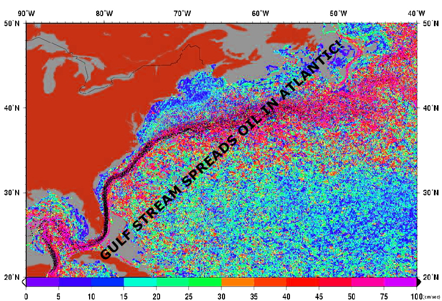
| Simulation of oil spread by Gulf Stream |
It's about fifty years ago that marine scientists, oceanographers started to find out about these swirly movements (geostrophic turbulence [1]) hundred and fifty years after they started to map the big persistent current at the east coast of North America, the Gulf Stream. Most ocean currents look much different then this big stream of water, which is moving steadily across the widths of the sea.
[1] "Geostrophic trubrulence is the chaotic, non-linear motion of fluids that are near the state of geostrophic and hydrostatic balance." (Peter B. Rhines 1979, Annual Review of Fluid Mechanics Vol. 11: 401-441)
There are several of these visible streams out there; they are powerful and dramatic – be it the Gulf Stream in the Northern Atlantic or the Kuroshio (黒潮 "Black Tide") in the North Pacific. These currents, focused by an effect of the rotation of the earth stting the geostrophic balance, are mainly found at the east coasts of the continents moving poleward, and are the western branch auf the giant swirl covering the width of the ocean basin. In general the ocean water movements are much more like a wavy drift of swirly They may be persisting rings of the Agulhas Current shed off south of Cape Hope or they are just transient features, sometimes forming more or less repetitive patterns.
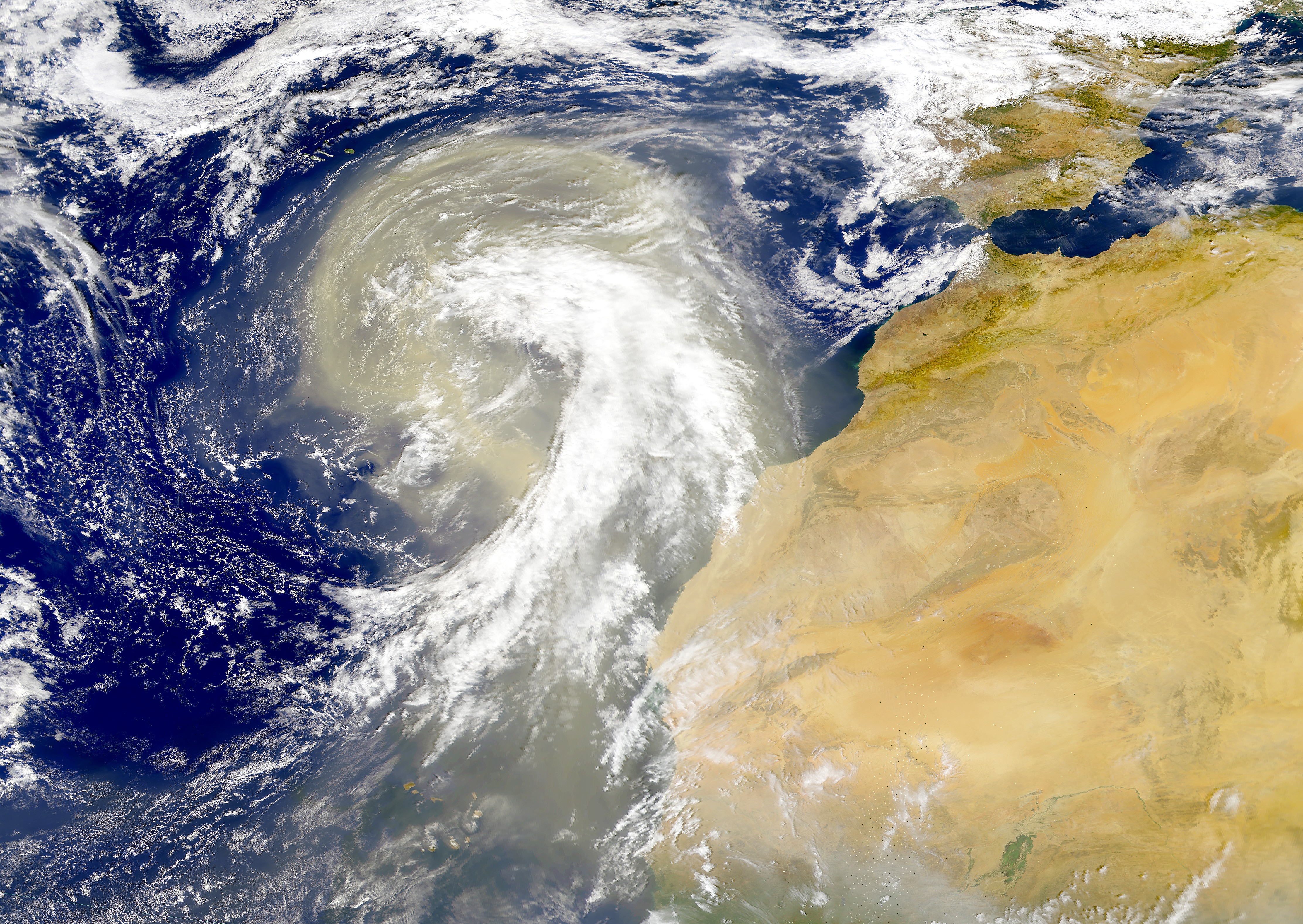 |
| Dust plume off the Sahara desert over the Atlantic Ocean. SeaWiFS satellite picture |
 |
| Plankton bloom in the Baltic Sea (Satellite picture published by BBC 23rd July 2010) |
Often a swirl is are made of water having a slightly different composition, salinity, temperature or nutrients then the neighbouring swirl. This then may go together with different marine life [*], which often flourishes best at the border zone between swirls.
Recently NASA has given the public
a fascinating, realistic show
(Video)
of the surface currents of the world ocean – an global sea full of giant swirls, big swirls, tiny
swirls of overwhelming beauty; modern computers rendered this animated show technical feasible [2]. These swirly currents carry water, salt, heat, debris,
pollution... over the globe, from one swirl to the next. These swirly
movements may dilute, but often they carry substances over wide
distances and gather them in places, if the conditions are right. Thus floating plastic debris are found accumulated in the mid of the ocean or are carried over the
width of the Pacific [**], as shown by the sneaker drift .
[2] NASA "This visualization shows ocean surface currents around the world during the period from June 2005 through December 2007. The visualization does not include a narration or annotations; the goal was to use ocean flow data to create a simple, visceral experience"
[2] NASA "This visualization shows ocean surface currents around the world during the period from June 2005 through December 2007. The visualization does not include a narration or annotations; the goal was to use ocean flow data to create a simple, visceral experience"
 |
| The East Anglian plume an sediments along the shoreline of Belgium and Holland. |
Mixing in the sea is slow, slower as one believes seeing the waves hitting the shore. The stabilizing effects of earth rotation and topography keep waters together in bands and swirls, so that there distinct constituencies are kept. The outflow of radionuclide of the nuclear wast processing plants in France (Le Hague) and UK (Sellaflield) can be traced following the European coast [***] up into the Baltic Sea .


Martin.Mundusmaris@gmail.com
info@mundusmaris.org
info@mundusmaris.org
[*] from Wikipedia: "Warm core rings are known to have lower primary productivity than surrounding cold waters. Agulhas Rings are no exception, and have been observed to carry waters with low chlorophyll-a concentration water into the South Atlantic... removing larval and juvenile fish from the continental shelf. This removal of young fish can result in a reduced Anchovy catch in the Benguela system if a ring passes through the fishery."
[**] from EOS, Transactions, American Geophysical Union Vol. 88, No. 1, 2 January 2007: "In 1992, a cargo container of children’s bath toys fell overboard in the middle North Pacific Ocean. Subsequently, 29,000 toys were tracked 4,000 kilometres to south-eastern Alaska... toys stranded on shorelines around the Subarctic Gyre, a planetary vortex the size of the United States."
[***] "Radionuclides (99Tc, 125Sb, 90Sr, 137Cs) discharged from La Hague in France have been used to trace advection and dispersion of water masses in the “European Coastal Current” from the English Channel to the Baltic... It is concluded, that 10% of the La Hague discharge is transported through Kattegat... This coastal transport is important when contaminant transport is monitored." (Radioactive tracers as a tool in coastal oceanography: An overview of the MAST-52 project H. Dahlgaard Journal of Marine Systems Volume 6, Issues 5–6, November 1995, Pages 381–389)
No comments:
Post a Comment